Do you live in an earthquake fault zone? Find out with new online maps
The California Geological Survey on Thursday released online earthquake fault zone maps for fault-ridden regions of the state, including most of the Bay Area.
The online map shows the state overlain by boxes representing every quadrangle -- an area of 62 square miles -- covered by an earthquake fault zone map. Clicking on a box lets users download the map. Only regions with active faults are mapped.

If property is located in an earthquake fault zone, that fact must be disclosed to a potential buyer. And undeveloped property may require a fault study before a home can be built.
"California is earthquake country," said John Parrish, California's state geologist and head of the California Geological Survey. "If people are purchasing property, they need to know whether they're in an earthquake fault zone."
With the online tool, available at www.quake.ca.gov/gmaps/ap/ap_maps.htm, property owners can determine if their parcel is in a fault zoned region by typing in its address. If the property is not in a zoned quadrangle, then there's no disclosure requirement, Parrish said.
"If they are in a zoned city or county, then they can take a closer look at the maps," he said.
More coverage on California earthquakes.
Inquiries about the earthquake fault zone maps can be sent to webmaster@consrv.ca.gov.
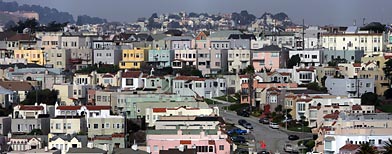
Caption: File: Homes stack up on a hillside in San Francisco on Wednesday, Feb. 9, 2004. (AP Photo/Marcio Jose Sanchez)
Read more here: http://news.yahoo.com/s/yblog_localsfo/20110215/ts_yblog_localsfo/d....
"Destroying the New World Order"
THANK YOU FOR SUPPORTING THE SITE!
Latest Activity
- Top News
- ·
- Everything
The Proper Definition Rather Than Democrat Rhetoric
Peter Sellers - The Party (opening scene)
Disgraced Former CNN Anchor Don Lemon Arrested
Our Crazy Modern World
2DF36465-A826-443C-A3A8-6638BC1D4FFA
G_LrzqtXMAAhT7w
© 2026 Created by truth.
Powered by
![]()
You need to be a member of 12160 Social Network to add comments!
Join 12160 Social Network